
A guide to incorporating business intelligence visualisations into a GovCMS SaaS website.
Frequently asked questions
Yes. Morpht has a dedicated maps and geodata practice, building flexible mapping solutions on top of ReactJS and mapping engines including Leaflet (for GeoJSON data) and Google Maps-based GeoCharts. Convivial for GovCMS includes native Map and GeoChart components. Morpht has delivered mapping solutions for government agencies that need to display service locations, environmental data, regional statistics, and spatial information in an accessible, responsive format.
Purpose-built mapping is typically needed when the map is core functionality rather than decoration; location-based service finders, spatial data visualisation, or interactive tools where accessibility, styling consistency, data source flexibility, or privacy considerations (avoiding third-party tracking embedded in some map providers) matter more than a simple embed can deliver.
Yes. Drupal's integration flexibility extends to connecting with spatial/GIS data sources and APIs, which is common in government use cases like environmental, planning or emergency-service mapping tools.
Yes. This is often overlooked; interactive maps need keyboard navigability and non-visual alternatives (e.g. accessible data tables or search-based alternatives to a purely visual map) to meet WCAG AA, since a map that's only usable by mouse/touch fails accessibility requirements regardless of how good it looks.
Insights


Article
Unlock geo personalisation features for your Drupal site by using Cloudflare workers to augment the request with geodata.

Case study
Morpht redesigned and uplifted The Australian Air Force Cadets website (GovCMS SaaS) with a new look and functionality.

Case study
In this case study, find out how Morpht integrated CRM, Google Maps, Customer Portal and Drupal to deliver a seamless user experience for the customer and editor alike.
Article
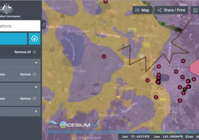
NationalMap has been added as a component to the Convivial starter site for GovCMS and GovCMS8.
Article
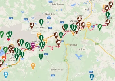
OpenLayers module is a popular solution for mapping in Drupal. The biggest benefit is the ability to use different map providers, complete Feature support and, last but not least, the simplicity of creating custom markers.
Related content
Service
Experienced backend Drupal developers build custom solutions for your business logic and requirements.
Service
Using the Drupal CMS and related web technologies we have delivered successful projects across a range of industries and clients.
Service
Skilled frontend developers and Drupal themers bring life to your website and designs.
Service
UX design considers every element that shapes your interaction with a product or service, how it makes you feel, and how easy it is for you to accomplish your desired tasks.